 Weather Satellite/Radar ImagesWeather Satellite/Radar Images
  US Current temps Map |
 US Current dew pt temps Map |
|---|---|
 US IR/Radar |
 Winds @ 300mb Map |
 United States Radar |
 500 mb plot |
 US Lightning Map US Lightning Map |
 3000 ft |
 IR/Fronts |
 Surface Winds |
 VFR/MVFR/IFR Surface Depict |
 Sea Surface Temp |
GOES-East
 75 West Long.Images are taken at 15 & 45 min past each hour |
|||||
|---|---|---|---|---|---|
| Images via 1024x900 B&W 30~67K JPEGs |
|||||
| Ch 1 - Visible: 0.52-0.72 um |
Ch 2 - Infrared: 3.78-4.03 um |
Ch 3 - Water Vapor: 6.47-7.02 um |
|||
| LOOP OF CURRENT EASTERN US SECTOR IMAGERY ~250K MPEG @ NOAA This MPEG movie contains the most recent 10 half hourly images of the East CONUS sector. |
|||||
| East Coast VISIBLE MPEG Loop | East Coast IR MPEG Loop | East Coast WATER VAPOR MPEG Loop | |||
| Images via |
|||||
| Full Disk 746x703 ~150K updated every 3 hrs | G12 Vis 0.65um | G12 IR3 6.75um | G12 IR4 10.70um | ||
| Northern Hemisphere 806x918 ~60K | G12 Vis 0.65um | G12 IR2 3.90um | G12 IR3 6.75um | G12 IR4 10.70um | G12 IR5 13.30um |
| Continental US (CONUS) 1781x506 (Squished) ~150K | G8 Vis 0.65um | G8 IR2 3.90um | G8 IR3 6.75um | G8 IR4 10.70um | G8 IR5 12.00um |
Images via 
| |||||
| East/West North America | IR/Topo 900x700 JPEG | IR 10.7um 900x700 JPEG | Vis/Topo 900x700 JPEG | IR/VIS 900x700 JPEG | |
| Eastern Canada | IR 10.7 um 1024^2 JPEG | Vis 1024^2 JPEG | IR/VIS 1024^2 JPEG | ||
| North and South America | Visible | IR 1024^2 JPEG | Vis 1024^2 JPEG | IR/VIS 1024^2 | 1/2 size MPEG |
| Eastern Canada | IR 10.7 micron | Full size 1024^2 JPEG | 1/2 size 512^2 JPEG | Full size MPEG | 1/2 size MPEG |
| Eastern North America | IR 10.7 micron | Full size 1024^2 JPEG | 1/2 size 512^2 JPEG | Full size MPEG | 1/2 size MPEG |
| North and South America | IR 10.7 micron | Full size 1024^2 JPEG | 1/2 size 512^2 JPEG | Full size MPEG | 1/2 size MPEG |
| Full-Disk Images @ NRL Monterey |
|||||
| GOES-8 CONUS-East with Color Overlay @ GSFC | |||||
GOES-West
 135 West Long.Images are taken at 01 & 31 min past each hour |
|||||
|---|---|---|---|---|---|
| Images via 1024x900 B&W ~630K GIFs |
|||||
| Ch 1 - Visible: 0.52 - 0.72 um |
Ch 2 - Infrared: 3.78 - 4.03 um |
Ch 3 - Water Vapor: 6.47 - 7.02 um |
|||
| Loops of current western US sector imagery (~250K MPEG)@ NOAA This MPEG movie contains the most recent 10 half hourly images of the WCONUS sector. |
|||||
| West Coast Visible MPEG Loop | West Coast IR MPEG Loop | West Coast WATER VAPOR MPEG Loop | |||
| Images via |
|||||
| Full Disk 1042x928 ~150K updated every 3 hrs | G10 Vis 0.65um | G10 IR3 6.75um | G10 IR4 10.70um | ||
| Northern Hemisphere 1135x663 ~70K | G10 Vis 0.65um | G10 IR2 3.90um | G10 IR3 6.75um | G10 IR4 10.70um | G10 IR5 12.00um |
| Pacific/US (PACUS) 1324x642 (Squished) ~90K | G10 Vis 0.65um | G10 IR2 3.90um | G10 IR3 6.75um | G10 IR4 10.70um | G10 IR5 12.00um |
| Images via
| |||||
| Western Canada | Visible | Full size 1024^2 JPEG | 1/2 size 512^2 JPEG | Full size MPEG | 1/2 size MPEG |
| Western North America | Visible | Full size 1024^2 JPEG | 1/2 size 512^2 JPEG | Full size MPEG | 1/2 size MPEG |
| Pacific North and South America | Visible | Full size 1024^2 JPEG | 1/2 size 512^2 JPEG | Full size MPEG | 1/2 size MPEG |
| Western Canada | IR 10.7 micron | Full size 1024^2 JPEG | 1/2 size 512^2 JPEG | Full size MPEG | 1/2 size MPEG |
| Western North America | IR 10.7 micron | Full size 1024^2 JPEG | 1/2 size 512^2 JPEG | Full size MPEG | 1/2 size MPEG |
| Pacific North and South America | IR 10.7 micron | Full size 1024^2 JPEG | 1/2 size 512^2 JPEG | Full size MPEG | 1/2 size MPEG |
| Full-Disk Images @ NRL Monterey |
|||||
| FullDisk_Animator @ Naval Research Lab |
|||||
| GOES West with Color Overlay @ GSFC | |||||
GMS
 140 East Long. |
||
|---|---|---|
|
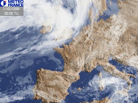
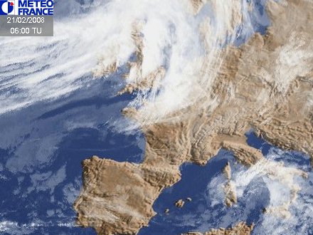
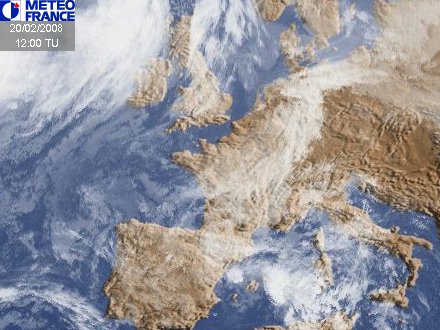
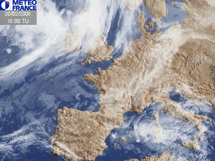
Meteosat
 0 West Long.Europe images : |
|---|
|
Geostationary Operational Meteorological Satellite GOMS-1
|
|
Moscow PlanetA (GOMS-1) Russian WX Satellite [not updated currently] (GOMS-1) Full Disk Images Russian WX Satellite [not updated currently] (GOMS-1) Full Disk IR Image @ U of Nottingham, UK [not updated currently] |
Meteosat-5
63 E Long.IndoEx images : |
|---|
|
Full Disk INDOEX Vis ,
IR @ NOAA GSS INDOEX IR Meteosat-5 @ 63E. copyright c 2003 EUMETSAT INDOEX Vis, IR, WV at Dundee University free registration req. |
Geostationary Chinese Satellite |
|||||
|
FY-2 transmissions are limited to these approximate times: 0300, 0400, 0500, 0600, 0700, 0800Z National Satellite Meteorological Center (NSMC) China
|
|||||
Geostationary India Satellite
|
|||||
|
Full Disk: Vis (0.47-0.70 micron) IR (10.5-12.5 micron) Vis/IR Color Composite 512x550 jpeg
India: |
|||||
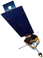
GOES-11 (Central/Spare)
104 West Long.In 'On orbit' storage, no images sent since Aug 14, 2000 at end of checkout. |
|||||
|---|---|---|---|---|---|
| Images via |
|||||
| Test Images updated every 30 minutes | G11 Vis 0.65um |
G11 IR2 3.90um |
G11 IR3 6.75um |
G11 IR4 10.70um |
G11 IR5 12.00um |
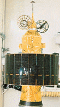
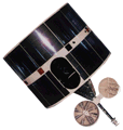
GOES-12 (Central/Spare)
104 West Long.GOES-12 will replace GOES-8 and become the new operational GOES-East satellite on March 31, 2003. |
|||||
|---|---|---|---|---|---|
| Images via |
|||||
| Test Images updated every 30 minutes | G12 Vis 0.65um |
G12 IR2 3.90um |
G12 IR3 6.75um |
G12 IR4 10.70um |
G12 IR5 12.00um |
All together now... GMS, GOES and Meteosat
|
|
|
 |
|
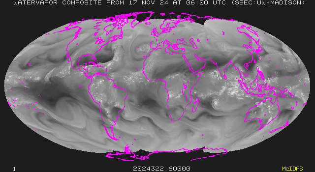
Superpolar IR Composite 768x480 ~368K GIF by WSI @ intellicast Mollweide IR 640x350 ~115k GIF @ UW-SSEC Mollweide WV 640x350 ~90k GIF @ UW-SSEC Mollweide IR/Topography 640x480 ~70K GIF @ UNIDATA/UCAR Mollweide land/sea temp/cloud 7 day MPEG movie ~1M frame every 3 hrs @ UW-SSEC Current lo-res spinning Globe MPEG movie ~2 MB @ UW-SSEC off-line since 10-8-2002 Current hi-res spinning Globe MPEG movie ~5.7 MB @ UW-SSEC off-line since 10-8-2002 Two-week lo-res spinning Globe MPEG movie ~2 Mb @ UW-SSEC off-line since 10-8-2002 Two-week hi-res spinning Globe MPEG movie ~5.7 Mb @ UW-SSEC off-line since 10-8-2002 |
![]() Antarctic Composite The Antarctic composite is a mosaic of GOES, Meteosat, GMS, and NOAA satellite data. @ UW-SSEC
Antarctic Composite The Antarctic composite is a mosaic of GOES, Meteosat, GMS, and NOAA satellite data. @ UW-SSEC
![]() Antarctic Composite @ Weather Channel
Antarctic Composite @ Weather Channel
![]() AF Global Weather Center Northern / Southen Hemisphere DMSP IR mosaics updated every 6 hrs (1 day delay) @ National Geophysical Data Center
AF Global Weather Center Northern / Southen Hemisphere DMSP IR mosaics updated every 6 hrs (1 day delay) @ National Geophysical Data Center
NO data since Jan 1999. If anybody knows where to find current data in this format let me know.
Polar Orbiters NOAA 12,14,15 and DMSP F12,13,14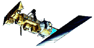
|
|
GAC--Global Area Coverage: LAC--Local Area Coverage: CIRA collects, processes, and archives all the Polar orbit NOAA-12 and NOAA-14 Advanced Very High Resolution Radiometer (AVHRR) Local Area Coverage (LAC) and Global Area Coverage (GAC) [one orbit per image] data re-transmitted by the Gilmore Creek, Alaska earthstation via DOMSAT.
Band Satellites:          IFOV
    NOAA-7,9,11,12,14
=== ==================== =======
1   0.58  - 0.68          1.39   Visible
2   0.725 - 1.10          1.41   Red Visible - Near IR
3   3.55  - 3.93          1.51   Short IR
4   10.3  - 11.3          1.41   Long IR
5   11.5  - 12.5          1.30   IR
     (micrometers)    (milliradians)
Note: CIRA GAC jpeg images are ~50k 206x2129 x 24 bit (new smaller size as of Mid Aug '97) |

 EarthWatch ® EarthWatch ® |
2-D WX US Visible ~40k | WX US IR ~40k | WX US Radar ~40k |
|---|---|---|---|
2D-IR US Sections576x437 ~ 30k JPEGS |
North West | North Central | North East |
| South West | South Central | South East | |
| StormWatch | WX Headlines | NE Pacific | N Atlantic |
![]() Climate News @ Marshal Space Science Lab
Climate News @ Marshal Space Science Lab
![]() Univ of ND Regional Info Center WX info my old home '79-'83
Univ of ND Regional Info Center WX info my old home '79-'83
![]() Global Hydrology and Climamate Ctr @ MSFC
Global Hydrology and Climamate Ctr @ MSFC
![]() Naval Research Lab GOES-9 Photos & Movies
Naval Research Lab GOES-9 Photos & Movies
![]() Todays Space Weather @ NOAA Space Environment Laboratory
Todays Space Weather @ NOAA Space Environment Laboratory
![]() Space Weather Bureau @ Marshal Space Science Lab
Space Weather Bureau @ Marshal Space Science Lab
![]() Real Time Weather for Meteorologists @ UCAR
Real Time Weather for Meteorologists @ UCAR
![]() WX.com free, interactive Internet weather source. Available to the public from Meteorlogix
WX.com free, interactive Internet weather source. Available to the public from Meteorlogix
![]() SARSAT Search And Rescue SATellite @ NOAA
SARSAT Search And Rescue SATellite @ NOAA
![]() Sprites and Jets @Alaska.edu
Sprites and Jets @Alaska.edu
![]() SeaWiFS Project @ GSFC
SeaWiFS Project @ GSFC
![]() Weather Software @ U Mich
Weather Software @ U Mich
![]() WeatherSites 380+ and growing @ U Mich
WeatherSites 380+ and growing @ U Mich
![]() Yahoo Weather images images by Weather News Inc
Yahoo Weather images images by Weather News Inc
![]() Weather Channel
Weather Channel
![]()
Send Comments/Suggestions on this page to BenHuset@SkyPoint.com
![]()
| Web Pages by | Ben |
| Last Updated: | June 16th, 2003 |
| Page counter started Sept 18,1997: |
